
News / Local
22 June 2026
Motorway tops funding wish list


Published 2:07pm 30 September 2022
 Words by Jodie Powell
More than 15 million SMS messages, 6.6 million emails and 206,000 voice calls have been issued since the first MoretonAlert message was issued in December 2011.
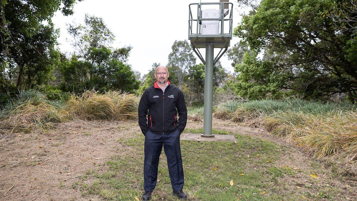
Moreton Bay Regional Council Emergency Management and Public Safety manager Carl Peterson says the service is a vital early warning system that can help people plan for a range of disasters.
Carl heads the team responsible for issuing MoretonAlerts and says a range of detailed data is used to determine when messages are sent, allowing people to plan and enact their emergency or evacuation plans.
So far this year, 357 alerts have been issued across the region – 234 of them in February relating to severe weather and/or flooding.

Alerts are issued either by Council’s Disaster Management team or Flood Information Centre team, depending on the situation.
Among the messages sent to those who’ve signed up are alerts for severe weather, bushfire warnings, notifications about Council burn-offs, impending flash-flooding and planned dam releases.
Each message includes basic information about each emergency and the level of threat to residents, as well as the action Council recommends taking.
With a wetter than usual spring and summer predicted and the Bureau of Meteorology declaring a third consecutive La Nina, Carl says MoretonAlert is a powerful tool.
|“If we can do our job well enough then people have the information to make informed decisions,” he says.|
Currently about 18 percent of Moreton Bay Region residents aged over 15 have registered to receive free MoretonAlerts – but Carl’s keen to see more sign up to stay informed and says a range of criteria must be met before an alert can be sent.
Severe weather warning alerts are only sent once the Bureau of Meteorology has issued an official warning for the Moreton Bay Region, while official warnings for the region issued by the Queensland Fire and Emergency Service are the trigger for bushfire alert messages.
Dam release alerts are sent after official notifications from Seqwater, and notification of planned Council hazard reduction burns are sent to MoretonAlert subscribers near the burn the day before.

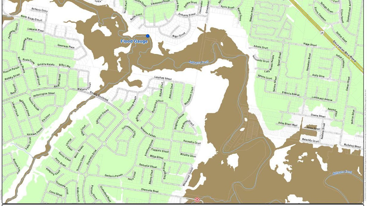
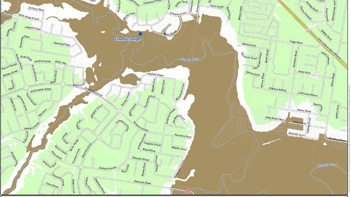
Carl says the region is home to more than 90 rainfall gauges and about 45 flood gauges, which provide crucial data for warning residents and visitors about potential flooding and flash flooding via MoretonAlert.
Each flood gauge has four warning levels, each with an accompanying map showing the possible extent of flooding and common road closure points.
The warnings range from level one – minor flooding could occur – to level four – expect major flooding.
MoretonAlert flood warnings cover 33 flood warning groups within eight of the region’s 14 catchments, ranging in size from one property to 707, with total coverage of 8084 land parcels.
To sign up for the free MoretonAlert service click here.


Caboolture Snakes have appointed former Sri Lankan Test captain Suranga Lakmal as head coach, ushering in a new era focused on player development and cricket success.

Ninety constructed wetlands across Moreton Bay are filtering thousands of tonnes of pollutants from stormwater each year, helping protect waterways, improve water quality and create healthier habitats for local wildlife.


Major high-rise plans are “way too much” for Ferny Hills, according to Brian Battersby, who represented the area for 40 years. The former councillor told Moreton Bay City Council’s meeting last week he “strongly opposed” the proposals for developments up to 12 levels.

More than 200 Beachmere residents today rallied and cited serious concerns against the planned Moreton Motorsport Park. They voiced fears over flooding risks, environmental contamination and impact on the town’s quiet coastal lifestyle, if the motorsport park is approved.

A new 3km walking circuit with lake views, picnic shelters and green areas will open at Moreton Bay Central today.


Work will officially start today on PsiQuantum’s new Moreton Bay Central facility where the world's first utility-scale, fault-tolerant quantum computer will be built.

For Men’s Health Week, Strathpine-based MISA is encouraging men to prioritise mental health, offering specialised counselling and support for blokes of all ages.

Bluey and Bingo are heading to Redcliffe for a free family event featuring live entertainment, activities, community services and fun for little Queenslanders.